| เว็บไซต์ Google (www.Google.com) เป็นเว็บไซต์ที่ให้บริการในการค้นหาข้อมูล ในโลกของอินเตอร์เน็ต โดยค้นหาข้อมูลจากข้อความ หรือตัวอักษรที่พิมพ์เข้าไป แล้วทำการค้นหาข้อมูล รูปภาพ หรือเว็บเพจที่เกี่ยวข้องนำมาแสดงผล เว็บไซต์ Google ได้รับความนิยมอย่างมากในกลุ่มผู้ใช้งานอินเทอร์เน็ตที่ต้องการค้นหาข้อมูล | ||||||||
| เว็บไซต์ Google แบ่งหมวดหมู่ของการค้นหาออกเป็น 4 หมวดหมู่ด้วยกัน ดังนี้คือ | ||||||||
| ||||||||
| วิธีการใช้งาน Google ค้นหาข้อมูลแบบติดจรวด | ||||||||
| การค้นหาโดยทั่วไปส่วนใหญ่แล้วจะใช้คำ Keyword เป็นเครื่องมือ ในการนำทางการค้นหาอย่างเดียว แต่ถ้าเรารู้จักใช้เครื่องหมายบางตัวร่วมด้วย ก็ จะทำให้ขอบเขตการค้นหาของ Google แคบลง ทำให้เราได้ข้อมูลที่ตรงกับความต้อง การมากขึ้น เครื่องหมายที่สามารถนำมาช่วยในการค้นหาได้ มีดังนี้ | ||||||||
| การค้นหาด้วยเครื่องหมายบวก (+) เหมาะสำหรับการค้นหาคำ Keyword ที่มีลักษณะเป็นตัวเชื่อม เพราะโดยหลักการทำงานของ Google แล้ว Google จะไม่ค้นหาคำประเภทตัวเชื่อม เช่น at, with, on, what, when, where, how, the, to, of ถึงแม้ว่าเราจะมีการระบุเหล่านี้ลงใน Keyword ด้วยก็ตาม | ||||||||
| ดังนั้นถ้าเราต้องการให้ Google ทำการค้นหาคำเหล่านี้ด้วย เนื่องจากเป็น คำสำคัญของประโยคที่เราต้องการ สามารถใช้เครื่องหมาย + ช่วยได้ โดยมีเงื่อนไข ว่า ก่อนหน้าเครื่องหมาย + ต้องมีการเว้นวรรค 1 เคาะด้วย เช่น ถ้าต้อง การค้นหาเว็บไซต์เกี่ยวกับเกมส์ที่มีชื่อว่า Age of Empire ถ้าเราพิมพ์ Keyword ...Age of Empire… Google จะทำการค้นหาแยกคำโดยไม่สนใจ of คืออาจจะค้นหา Age หรือ Empire แค่ตัวเดียว แต่ถ้าเราระบุว่า Age +of Empire Google จะทำการค้นหาทั้งคำว่า Age, of และ Empire เป็นต้น | ||||||||
ฺ
 | ||||||||
ภาพตัวอย่างการใช้เงื่อนไข (+)
| ||||||||
| การค้นหาด้วยเครื่องหมายลบ ( - ) จะช่วยให้เราสามารถตัดเรื่องที่เรา ไม่ต้องการ หรือไม่เกี่ยวข้องออกไปได้ เช่น ถ้าเราต้องการค้นหาเว็บไซต์ที่ เกี่ยวกับการล่องแก่ง แต่ไม่ต้องการ การล่องแก่งที่เกี่ยวข้องกับจังหวัดตาก ให้เราพิมพ์ Keyword ว่า ล่องแก่ง -ตาก (เช่นเดียวกับเครื่องหมาย + ต้องเว้นวรรคก่อนหน้าเครื่องหมายด้วย) Google จะทำการค้นหา เว็บไซต์ที่เกี่ยวกับการล่องแก่ง แต่ไม่มีจังหวัดตากเข้ามาเกี่ยวข้อง | ||||||||
 | ||||||||
ภาพตัวอย่างการใช้เงื่อนไข (-)
| ||||||||
| การค้นหาด้วยเครื่องหมายคำพูด ("...") เหมาะสำหรับการค้นหาคำ Keyword ที่มีลักษณะเป็นประโยควลี ที่เราต้องการให้มันแสดงผลทุกคำในประโยค โดยไม่แยกคำ เช่น ถ้าเราต้องการหาเว็บไซต์เกี่ยวกับเพลงที่มีชื่อว่า If I Let You Go ให้พิมพ์ว่า "If I Let You Go" Google จะทำการค้นหาประโยค "If I Let You Go" ทั้งประโยคโดยไม่แยกคำค้นหา | ||||||||
 | ||||||||
ภาพตัวอย่างการใช้เงื่อนไข ("...")
| ||||||||
| การค้นหาด้วยคำว่า OR เป็นการสั่งให้ Google ค้นหาข้อมูลเพิ่มมากขึ้น เช่น ถ้าเราต้องการค้นหาเว็บไซต์ที่เกี่ยวกับการล่องแก่ง ทั้งในจังหวัดตาก และปราจีนบุรี ให้เราพิมพ์ Keyword ว่า ล่องแก่ง ตาก OR ปราจีนบุรี Google จะทำการค้นหาเว็บไซต์ที่เกี่ยวกับการล่องแก่งทั้งในจังหวัดตาก และกาญจนบุรี | ||||||||
 | ||||||||
ภาพตัวอย่างการใช้เงื่อนไข (OR)
| ||||||||
| ||||||||
ภาพตัวอย่างวิธีการใช้งาน Google ของผู้เริ่มต้น
|
วันจันทร์ที่ 16 กันยายน พ.ศ. 2556
มารู้จัก google
GPS คือ
GPS คือ...
GPS ย่อมาจาก Global Positioning System หรือ "ระบบกำหนดตำแหน่งบนโลก"
ชื่อเต็มของระบบนี้คือ NAVSTAR Global Positioning System คำว่า
NAVSTAR เป็นอักษรย่อมาจาก Navigation Satellite Timing and Ranging ภาคของคำว่า ดาวเทียมสำหรับนำร่อง คือระบบที่ระบุตำแหน่งทุกแห่งบนโลก
เป็นระบบบอกตำแหน่งบนพื้นผิวโลก โดยอาศัยการคำนวณพิกัด
จากดาวเทียมระบุตำแหน่ง จำนวน 24 ดวง ที่โคจรอยู่รอบโลก ในระดับสูง ประมาณ 20,000 กิโลเมตร ทำให้สามารถชี้บอก ตำแหน่งได้ทุกแห่งบน โลกตลอดเวลา 24 ชั่วโมง 
จากการความสามารถดังกล่าว ทำให้ระบบดังกล่าวมีประสิทธิภาพ
ในการบอกตำแหน่งบนพื้นโลก อย่างที่ไม่เคยมีมาก่อนสำหรับประชาชนทั่วไป เพราะเดิมทีระบบ GPS เป็นระบบที่ถูกใช้งานการทหารของ กระทรวงกลาโหมของสหรัฐอเมริกา เท่านั้น
ด้วยความสามารถของ GPS ทำให้เราสามารถนำข้อมูลตำแหน่งมาใช้ประโยชน์ได้มากมาย เช่น
1. 1. GPS หาตำแหน่งที่แน่นอนบนพื้นโลกของเรา ป้องกันการหลงทาง, ในการหาจุดอ้างอิงต่างๆ เช่น ร้านอาหารโปรด สถานีตำรวจ

2. 2. GPS ใช้ในการแนะนำเส้นทางไปยังจุดต่างๆ บนโลก ดังที่เราเรียกว่า “ระบบนำทาง” หรือ “Navigator” ซึ่งมีให้กันใช้อยู่ทั่วไปในปัจจุบัน

3. ใช้ในการติดตามบุคคล หรือ ติดตามยานพาหนะ เพื่อใช้ในการตรวจสอบเส้นทางการเดินทาง
ที่ผ่านมา 
ทั้งนี้ ยังมีประโยชน์อีกมากมายที่จะสามารถประยุกต์ใช้งานได้มากมาย กับระบบ GPS
|
Google Maps
Google Maps มหัศจรรย์แผนที่ออนไลน์ 
.jpg)
.jpg)

Google Maps คือ บริการแผนที่ออนไลน์จาก Google แผนออนไลน์สุดยอดตัวนี้สามารถใช้งานได้หลายอย่าง เช่น หาตำแหน่งพิกัด ตรวจสอบสภาพการจราจร
Google Maps คือ อะไร?
เมื่อวันที่ 8 กุมภาพันธ์ 2548 Google ได้ประกาศใน Google Blog เพื่อแนะนำบริการใหม่ของ Google ที่มีชื่อว่าGoogle Maps ซึ่งเป็นบริการข้อมูลแผนที่ทั่วโลกที่ผู้ใช้สามารถใช้บริการได้ฟรีผ่านเว็บไซต์ http://maps.google.com ซึ่งตอนนี้สามารถใช้บริการภาษาไทยได้แล้วทาง http://maps.google.co.th
.jpg)
Google Maps รวมบริการหลายอย่างเข้าไว้ด้วยกัน เช่น ภาพแผนที่บนถนนหนทางต่างๆ ภาพถ่ายดาวเทียม ภาพถ่ายจากอากาศยานที่มีความละเอียดของภาพสูง บริการค้นหาสถานที่ห้างร้านต่างๆ บริการค้นหาเส้นทางจากสถานที่ต้นทางไปยังสถานที่ปลายทาง บริการภาพถ่ายจากถนนในเมืองสำคัญที่ทำให้ผู้ใช้เห็นสภาพแวดล้อมและอาคารบ้านเรือนที่อยู่สองฝั่งถนน เป็นต้น
นอกจากนี้ Google Maps ประเทศไทยยังแสดงข้อมูลที่เฉพาะเจาะจงสำหรับผู้ใช้งานคนไทยในกรอบด้านซ้ายมือได้แก่ รายชื่อเมืองดังๆ แผนที่ยอดนิยมและลิงก์สำหรับเพิ่มรายชื่อธุรกิจของคุณบน Google Maps
หัวข้อรายชื่อเมืองดังๆ แสดงชื่อจังหวัดและสถานที่แหล่งท่องเที่ยวที่มีชื่อเสียงของไทย ซึ่งผู้ใช้สามารถคลิกเพื่อไปยังสถานที่เหล่านั้นได้ทันที
ส่วนหัวข้อแผนที่ยอดนิยมจะแสดง Mapplet (โปรแกรมขนาดเล็กซึ่งพัฒนาโดยบุคคลทั่วไป ซึ่งสามารถทำงานได้บนหน้าเว็บไซต์ Google Maps) โดยในตอนนี้มีโปรแกรมสำหรับแสดงตำแหน่งของสถานที่จัดงานอีเวนท์ต่างๆ เช่น สถานที่จัดคอนเสริต ดาเอนโดรฟิน ดังรูป โดยงานอีเวนท์ต่างๆเหล่านี้จัดทำโดย ไทยทิคเก็ตเมเจอร์
.jpg)
ทั้งนี้ยังสามารถแสดงในส่วนของงานคอนเสริต(Concert) การแสดง (Performance) กีฬา (Sport) ท่องเที่ยว (Tour & Travel) และ สถานที่ Shopping รวมถึงการค้นหาโรงภาพยนต์ในประเทศไทย และร้านอาหารด้วยครับ

นอกจากนี้ Google Maps ยังถูกพัฒนาขึ้นมาโดยใช้หลัก Lightweight Programming Model ทำให้ผู้ใช้สามารถโหลดได้เร็วและยังอนุญาตให้เจ้าของเว็บไซต์นำโปรแกรม Google Maps ไปติดตั้งในเว็บไซต์ของตัวเองโดยใช้ Google Maps API และสร้างบริการต่อยอดขึ้นมาได้เองด้วย เช่น บริการค้นหาหอพัก บริการแสดงข้อมูลการเกิดอาชญากรรมในสถานที่ต่างๆ เป็นต้น
ด้วยการให้บริการฟรี ทำให้ข้อมูลแผนที่ที่แต่เดิมมีเพียงบริษัทไม่กี่แห่งที่สามารถเข้าถึงข้อมูลได้ และยังมีค่าใช้จ่ายค่อนข้างสูง ได้กลายเป็นข้อมูลสาธารณะที่ปัจเจกบุคคลทั่วไปสามารถใช้งานได้ฟรีและธุรกิจต่างๆ ยังสามารถประยุกต์ใช้เพื่อสร้างรายได้เพิ่มและลดต้นทุนการดำเนินงานลงได้ด้วย
เป็นยังไงกันบ้างละครับสำหรับ Google Maps สุดยอดไปเลยใช่มั้ยละ บริการของเค้านั้นดีจริงๆ ขอบอก ไม่เพียงเฉพาะการบริการบน PC ผ่านอินเตอร์เน็ตเท่านั้น Google Maps ยังให้บริการบนมือถือด้วย ซึ่งฟังก์ชั้นการทำงานต่างๆ นั้นเหมือนกับบนPC เลย ไว้คราวหน้าจะมาพูดถึงเรื่อง Google Maps บนมือถือนะครับ
วันอาทิตย์ที่ 1 กันยายน พ.ศ. 2556
Interesting «Google Earth»
Interesting «Google Earth»
In this collection you will find interesting satellite images obtained
by means of service Google Earth.
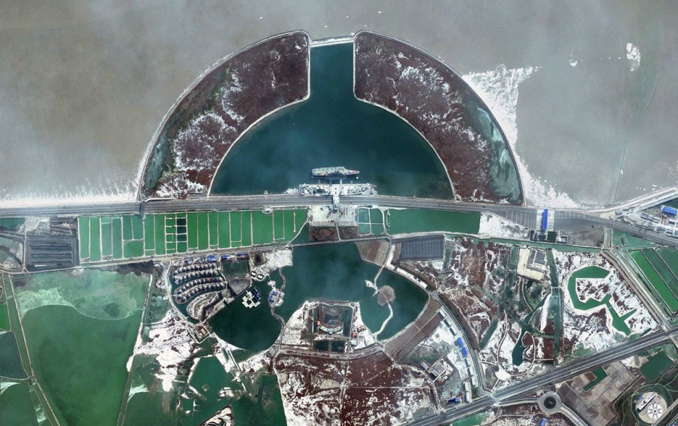
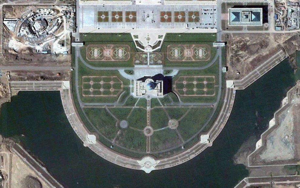
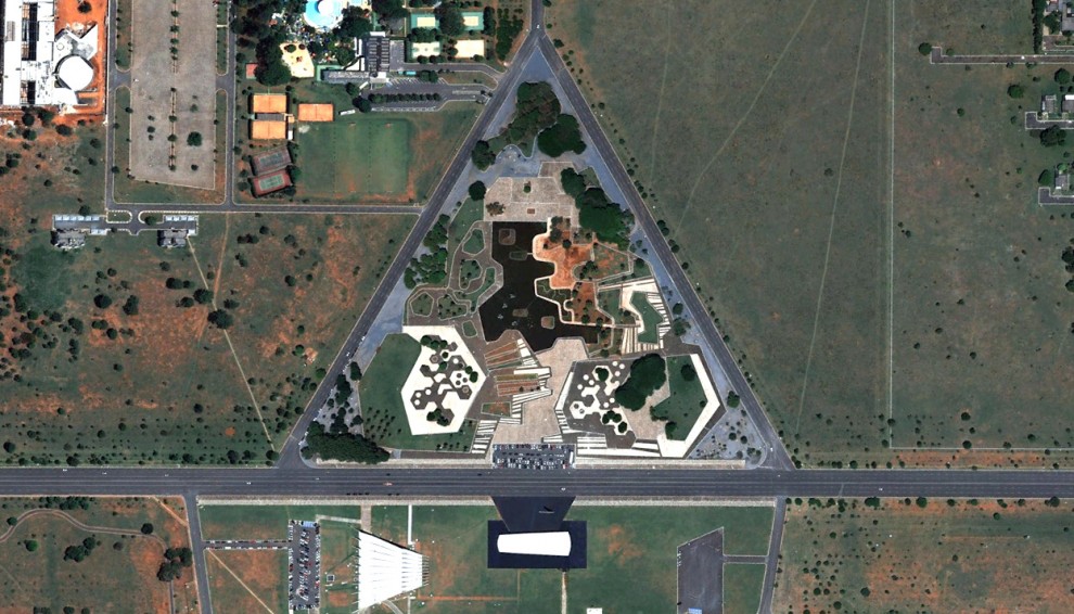
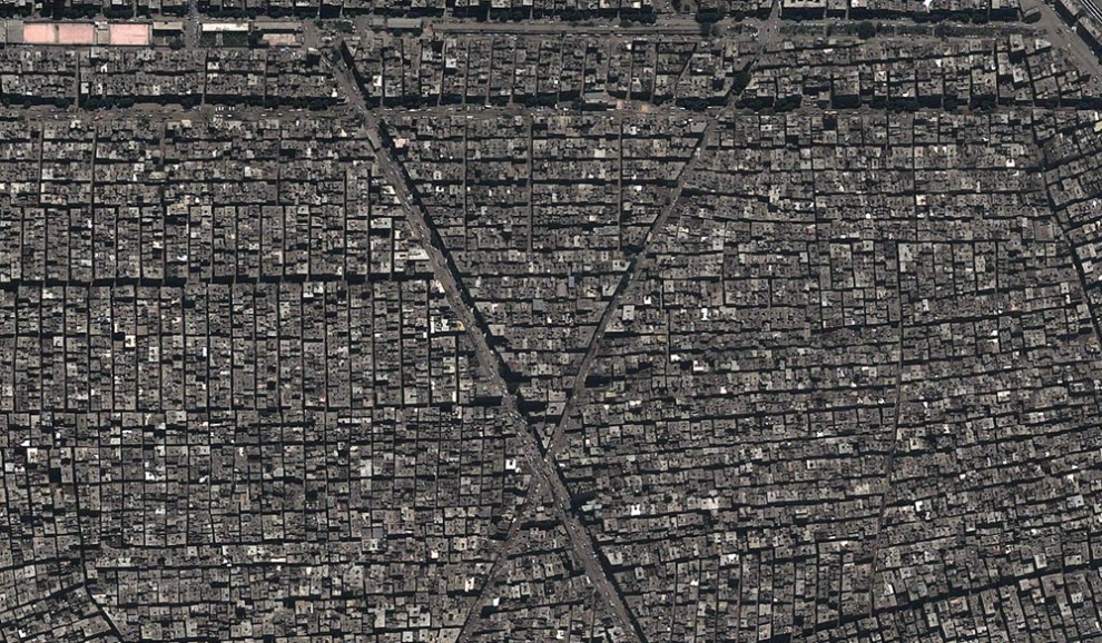
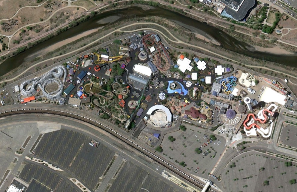
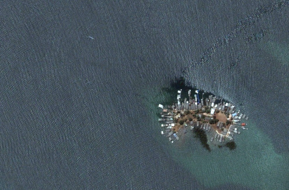
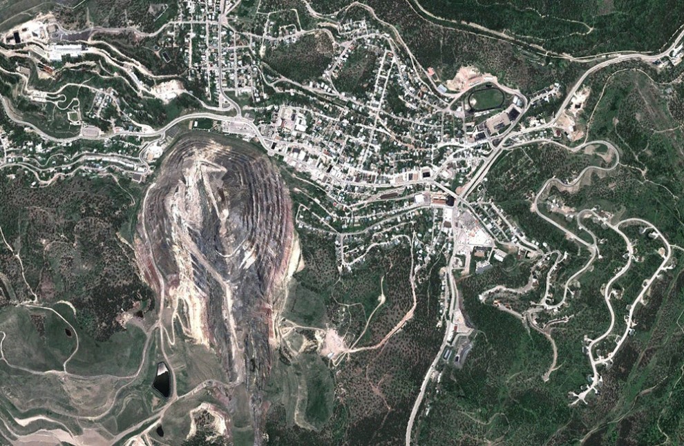
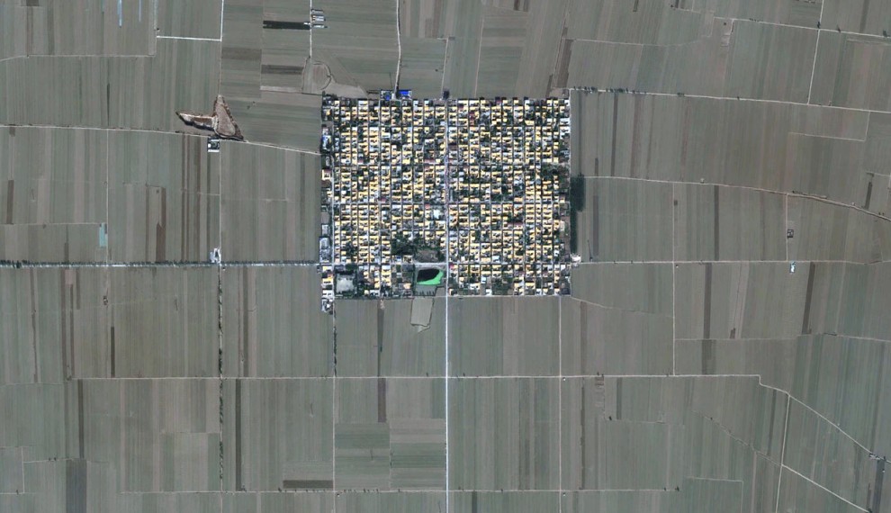
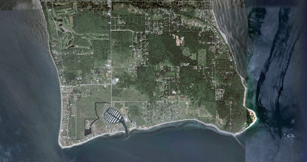
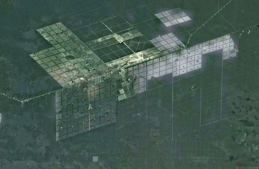
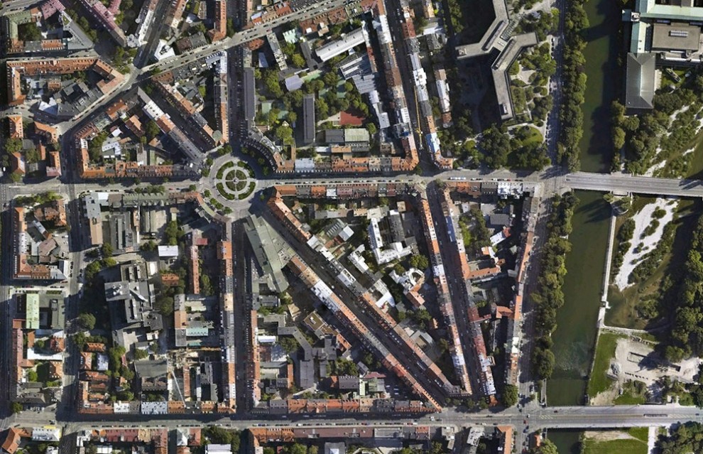
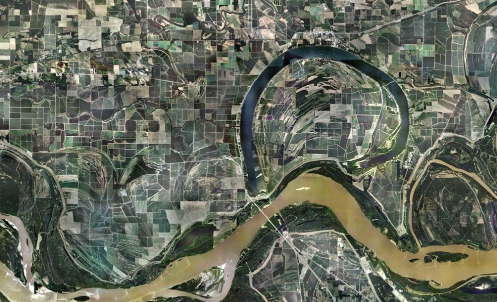
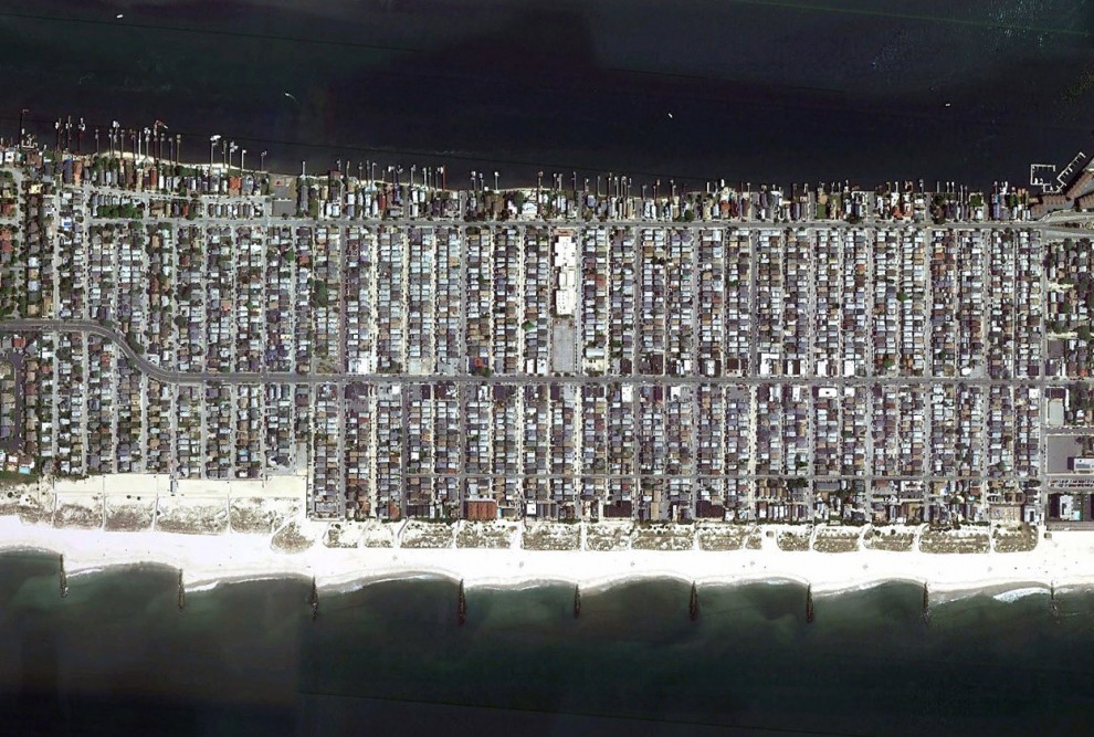
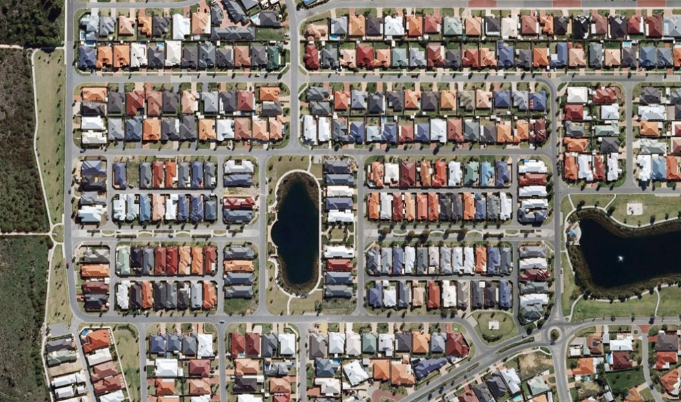
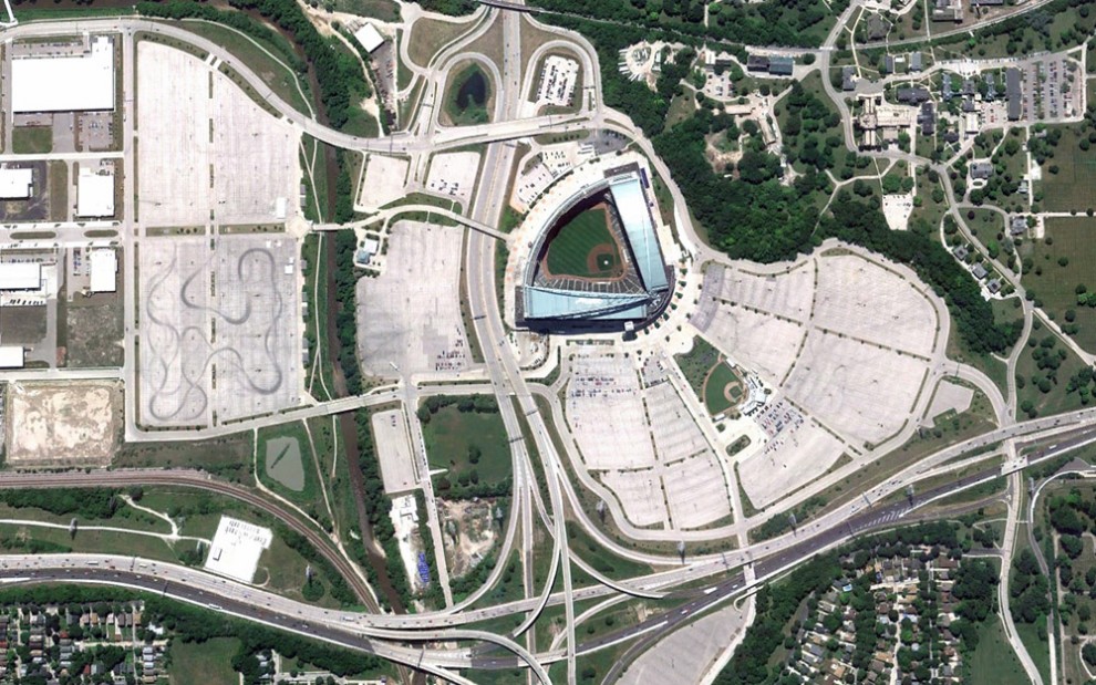
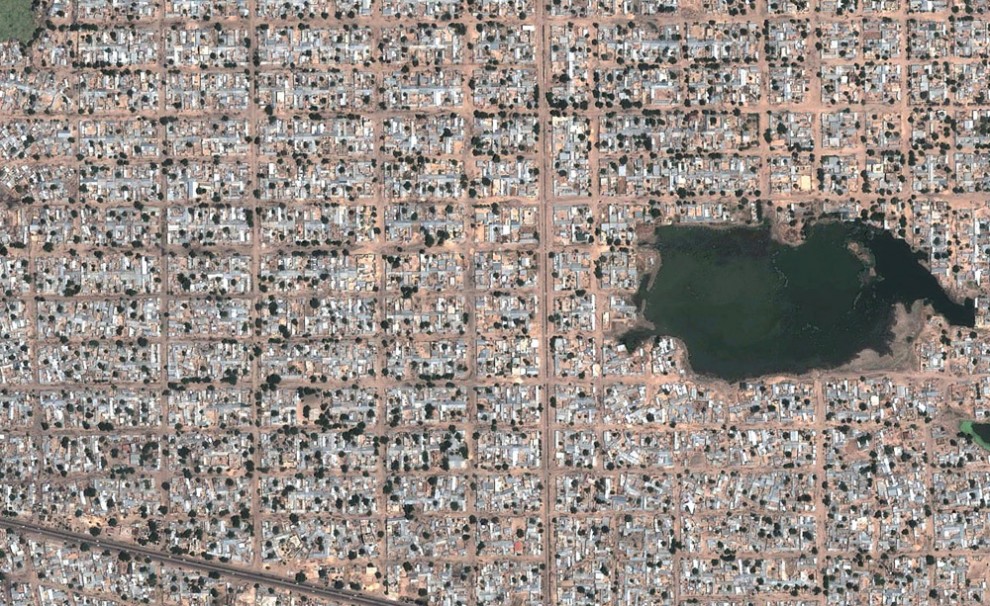
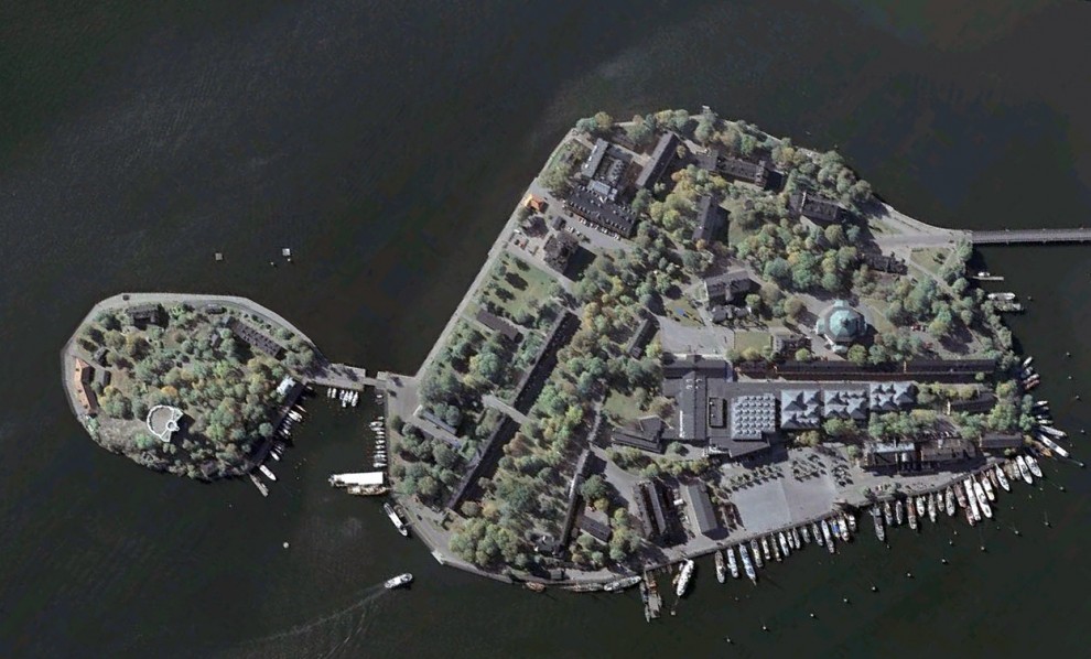
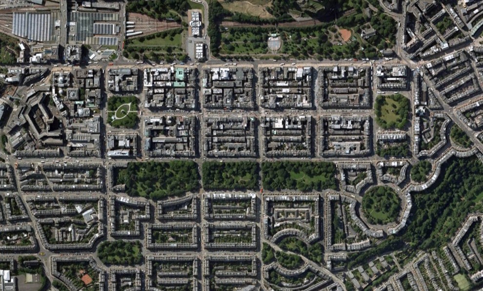
In this collection you will find interesting satellite images obtained
by means of service Google Earth.

1. The military theme park «Binhai Aircraft Park» in Tianjin,
China. (Google, GeoEye, TerraMetrics)

2. Ak Orda - the residence of the President of the Republic of
Kazakhstan in Astana, capital of Kazakhstan. (© Google, GeoEye, DigitalGlobe)

3. Park «Praça dos Cristais» in Brasilia, Brazil. ( Google, Tele Atlas, MapLink)

4. Densely populated area of Imbaba in the historic Cairo,
Egypt. ( Google, GeoEye)

5. Theme Park «Elitch Gardens», Denver, Colorado. ( Google)

6. Riau Archipelago, Indonesia. ( Google, DigitalGlobe)

7. Gold-mine «Homestake Mine», Leeds, South Dakota. ( Google, GeoEye)

8. Town surrounded by farmland, in Gaocheng, Hebei Province,
China. ( Google, GeoEye)

9. Point Roberts, Tsawwassen, British Columbia. (Google, DigitalGlobe)

10. The fields in the department of Boqueron in western
Paraguay. (Google, GeoEye)

11. Gärtnerplatz area in the center of Munich, Germany.
( Google, COWI A / S)

12. The quaint relief and farm along the banks
of the Mississippi River near Lake Village, Arkansas, USA. (© Google)

13. Long Beach, New York. (Google)

14. Multi-colored roof in the coastal area in Rockingham,
Australia. (Google, Whereis Sensis)

15. Stadium «Miller Park» in Milwaukee, Wisconsin. ( Google)

16. District Ndjamena, capital of Chad. (Google, GeoEye)

17. Skeppsholmen, Stockholm, Sweden. ( Google)

18. Edinburgh, Scotland. (Google, Infoterra Ltd. And Bluesky)
Places which are forbidden to display on Google Maps
Places which are forbidden to display on Google Maps
Mapping service Google Maps displays the entire Earth. Well, almost all. Some places are just not available for viewing or specially painted over or washed out.
 A man who identified himself as "Dr. Boylan" believes shaded area in this image and in some other locations, hiding extraterrestrial beacons aliens.
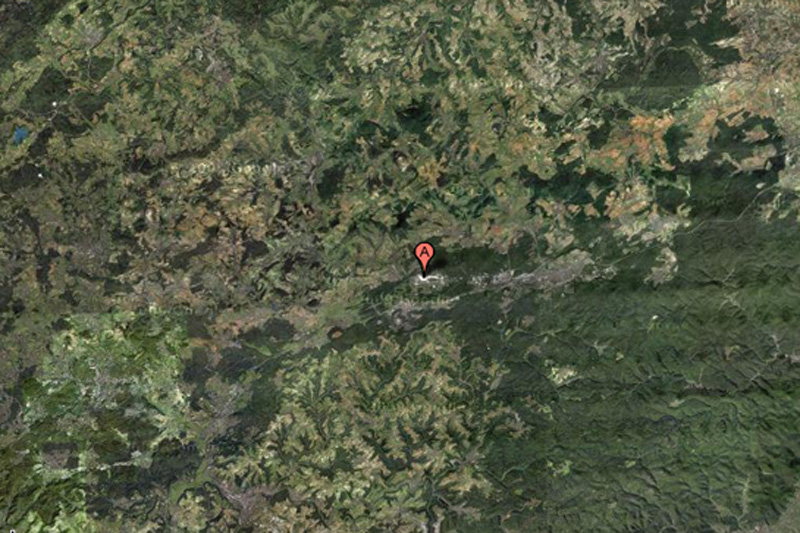 This NATO air base is the starting point for the forces of "Operation Iraqi Freedom", and for this reason can certainly be a target for terrorist attacks. This may explain why the object is partially carved out of Google Maps.
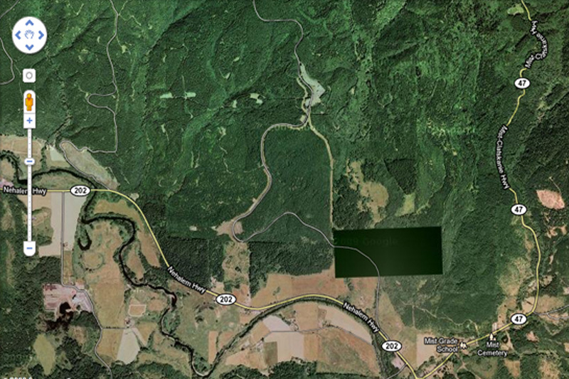 What exactly we do not see in this photo? This place is not far from the border of the states of Washington and Oregon. Enthusiasts have personally inspected the place and found nothing remarkable but ominous-looking fence and no marked entrance.
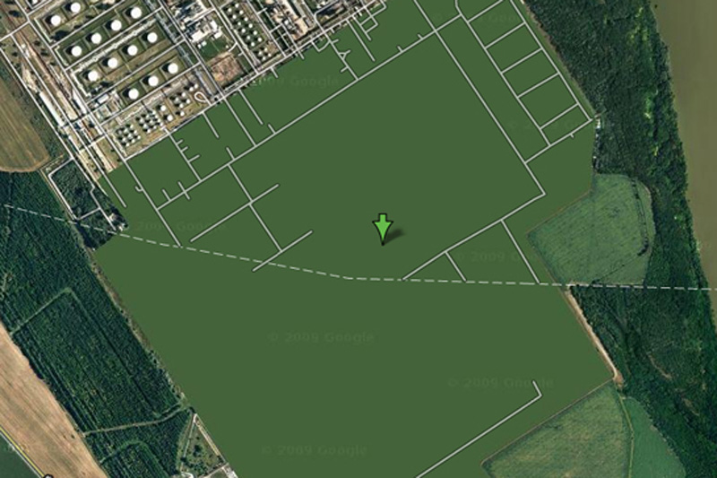 This is one of the most bizarre specimens of censorship in Google Maps - this place is just drawn in green. Area of the plant is removed, the building erased, and all you can see - this is a common herb.
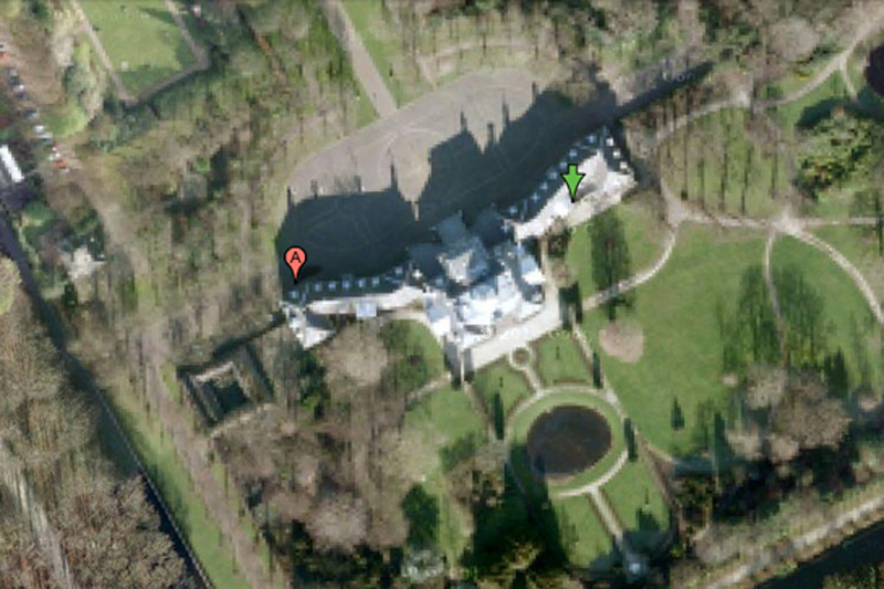 It is difficult to imagine that the Dutch royal family can be a prime target for mad terrorists, but the royal palace Hyuis Ten severely eroded on Google Maps when viewed from any angle. (However, the surrounding area and trees at close increase seen in crystal clarity.)
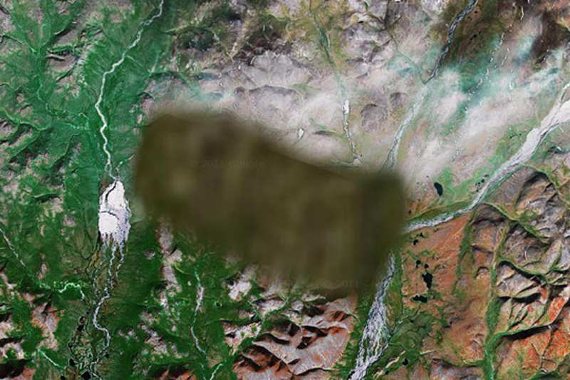 No one knows what lies in the region. One view - that there is a "radar or missile interception system," and some say that a picture is inserted into the surrounding area from another region of Russia.
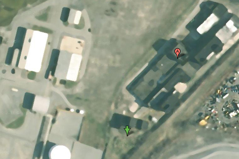 Some have criticized the company for Mobil of Buffalo blur pictures of her business, saying that oil companies are not much of interest to terrorists. On the other hand, we do not know what they think the terrorists themselves.
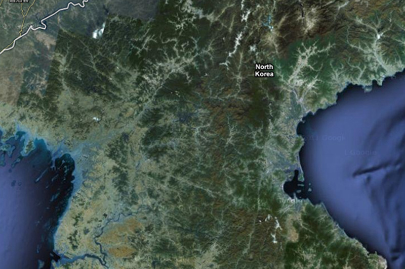 About the country of the alleged "Axis of Evil", heard everything, but very few people have ever visited her. You will not see it on Google Maps, since the whole country exists in images but without road markers, street names or any other identifying details.
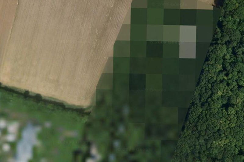 The reasons for this air base locked in Google Maps, is unknown.
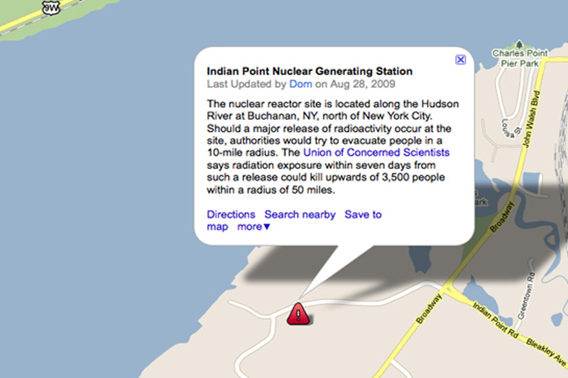 Many members of the government of the United States called for a halt Indian Point power plant. In addition to environmental concerns, according to experts in the field of energy, the power is not strong enough to withstand an earthquake, such as the one recently destroyed Japan.
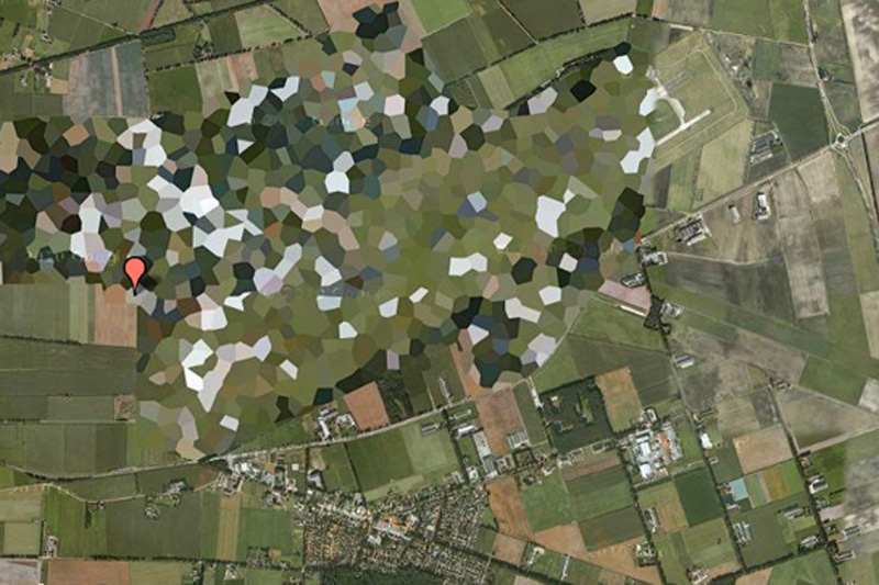 Pretty funny to see how rough blurred this air base in satellite images, however, WikiLeaks published diplomatic correspondence, which confirms the presence of nuclear weapons on the territory of the base.
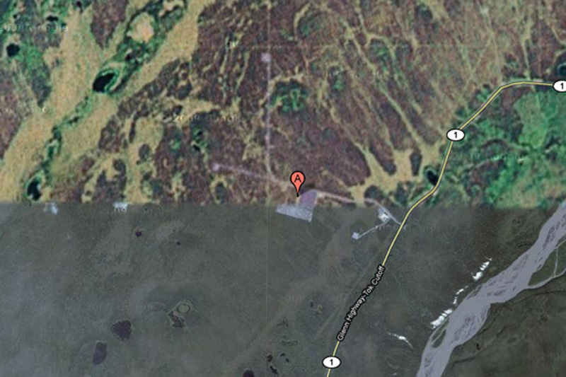 HAARP (High-Frequency Program Northern Lights) - this is one of the most controversial operations, which is currently being conducted in the United States. Hakon, space research, and ongoing experiments with the ionosphere there, some conspiracy theorists are honored to be the cause of anything - from floods to earthquakes, but very little evidence of this.
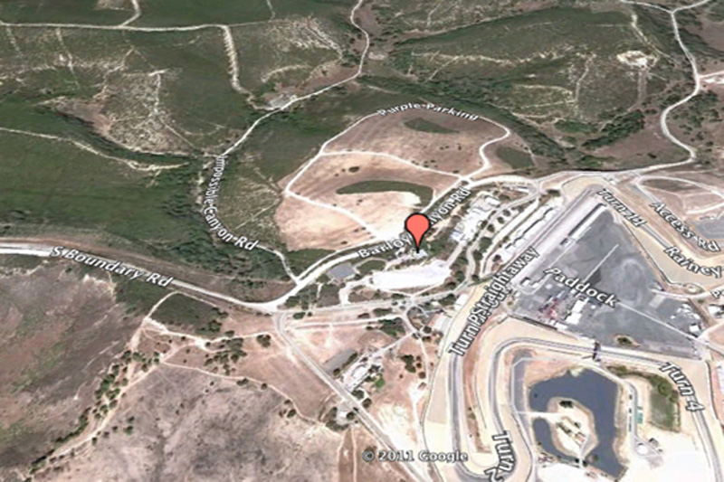 This is one of the most bizarre examples of censorship in Google Maps: Raceway Laguna Seca in Salinas, California. The strange thing in this is the fact: it is obviously harmless racing track.
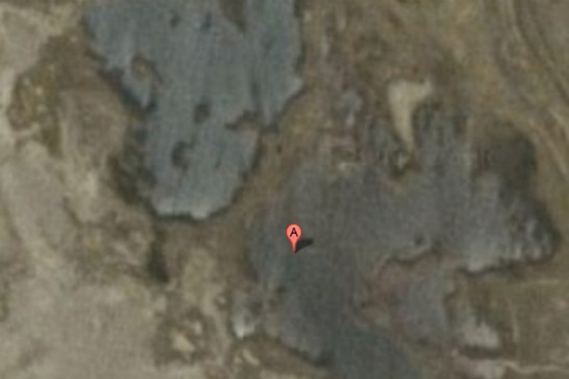 While the surrounding area has excellent visibility, the city of Babylon in the pictures blurred. You can bet that it has something to do with local rebels ...
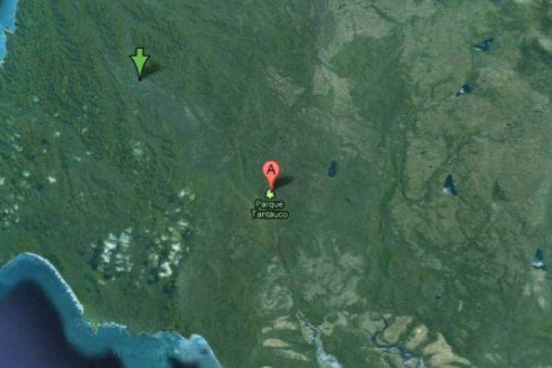 For some reason, this preserve endangered species completely excised from Google Maps? No one knows.
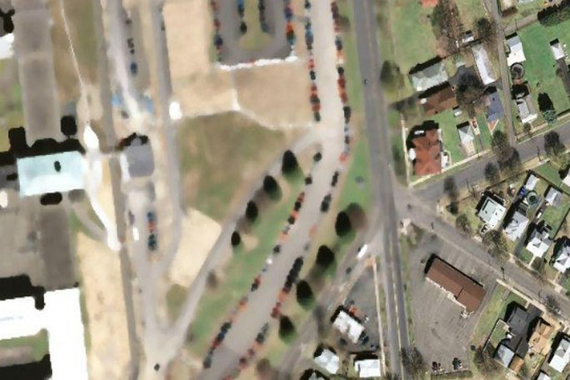 This is the highest level of reliability prison in the state of New York. Perhaps, after the riots in Attica prison, and several incidents of uprisings and mass escapes around the world, the authorities can really worry about the possibility of escapes by helicopter.
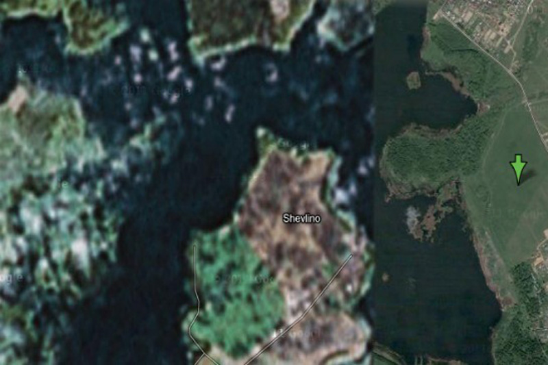 According to Wikipedia, this place is a "private palace Gazprom CEO Alexei Miller." But why is it in preference to all other people? Perhaps we are just not powerful enough to convince Google to cut our homes with satellite imagery.
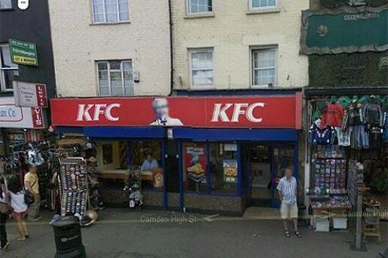 This is the strange fact from Google: Colonel Sanders, the person network Kentucky Fried Chicken, does not appear in a single shot from Google Street View. This is because, according to representatives of Google, which Sanders was a real person, and the images of real people have to be eroded in any pictures.
 It is believed that in this area there are some unpublicized military installations.
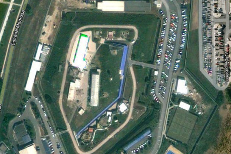 This shot would have been the most fun, if not had such a sinister context. Whoever edited the picture of Portuguese NATO headquarters, he simply copied the other part of the earth surface over the image of the building. Very strange.
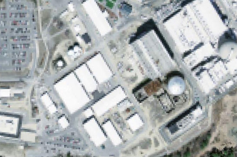 It is believed that in the north-eastern part of the United States is a nuclear power plant in Seabrook.
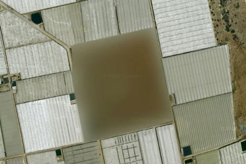 According to one researcher, "At this place there is a small structure with something resembling a missile silo in between. What's strange - this zone is not locked in Yahoo! Maps, but its image is not Google Maps ».
 We're not quite sure, which means «The Marcoule site of the Commissariat l'Energie Atomique», but we think that the word «atomique» here is the key.

1. Baker Lake, the territory of the Inuit in northern Canada

2. Air base Ramstein, Germany

3. Pacific Northwest, USA

4. Oil refinery Shazalombatta, Hungary

5. Palace Hyuis Ten, The Netherlands

6. Unknown zone, Russia

7. Oil Corporation Mobil, Buffalo, New York, USA

8. North Korea

9. The airbase at Reims, France

10. Indian Point Power Station, New York, USA

11. Volkel Air Base, Netherlands

12. HAARP, Hakon, Alaska, USA

13. Mazda Raceway Laguna Seca, Salinas, California, United States

14. Babylon, Iraq

15. Tantauko National Park, Chile

16. "The Hill", a correctional facility in Elmira, USA

17. House Alexei Miller, Russian

18. Colonel Sanders

19. Faroe Islands, Denmark

20. The NATO headquarters, Portugal

21. Seabrook Nuclear Station, New Hampshire

22. Missile silo, Spain

23. Nuclear area, France
สมัครสมาชิก:
ความคิดเห็น (Atom)

